 This page outlines a number of on and off road cycle routes, with low traffic density in and around Woodhall Spa. They all start in Jubilee Park, Woodhall Spa. Route 1 of the National Cycle Network (Harwich to Hull), crosses the River Witham on Kirkstead Bridge, on the western edge of Woodhall Spa.

River Witham, Southrey
Route 1 - Bardney & Southrey
National Cycle Network (Route 1) & the Water Rail Way
Start from Jubilee Park - Grid Reference: TF 189635
This route follows the road to Bardney and returns on the Water Rail Way
Places of interest: River Witham, Tupholme Abbey, Bardney Heritage Centre, Southrey Church
Traffic: Zero on Water Rail Way, light on road
Terrain: Mostly flat
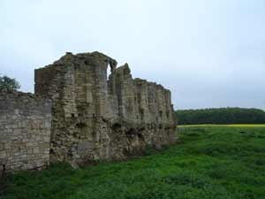
Tupholme Abbey near Bardney
Turn left out of Jubilee Park onto Stixwould Road and head for Stixwould village.
Turn left at the T-junction into the village of Stixwould (3.5 km). A Cisterian Priory was founded at Stixwould in the 12th century. Unfortunately, none of the Priory buildings survive and a farm was built on part of the site during the 18th century.
At the next T-junction (7 km) turn left onto the B1190 and proceed through Bucknall village (9.6 km). It is claimed that Lady Godiva was born here.
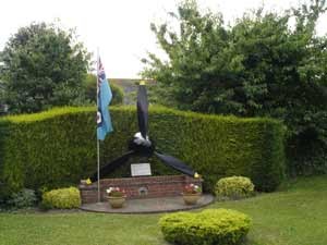
Photo 3 - 9 Sqn Memorial, Bardney
The route passes the ruins of the Premonstratensian Tupholme Abbey (11.5 km) founded in the middle of the 12th century.
Half a mile beyond Tupholme Abbey you have the option to turn left for refreshments in the village of Southrey (14 km), on the banks of the River Witham, and return to Stixwould and Woodhall Spa on the Water Rail Way. Otherwise continue on to Bardney (14.2km).
In Bardney village centre turn left and head down the hill for the bridge over the River Witham. Turn left onto the bridleway approximately 300 yards short of the bridge. After half mile take the right turn and head for the trees in the distance. Pass through the gate and you are now on the Water Rail Way. Select the bold text to visit the Water Rail Way page
![]()
![]()
![]() The Riverside Inn, Ferry Road, Southrey, LN3 5TA. Tel: 01526 398374
The Riverside Inn, Ferry Road, Southrey, LN3 5TA. Tel: 01526 398374
![]()
![]() Bardney Heritage Centre, Station Yard, Station Road, Bardney, LN3 5UF. Tel: 01526 397299
Bardney Heritage Centre, Station Yard, Station Road, Bardney, LN3 5UF. Tel: 01526 397299
Website: http://parishes.lincolnshire.gov.uk/BardneyGroup/se
Updated 9 Jan 21
Code of Conduct for Shared use Paths
Cyclists Please don't expect to cycle at high speeds and be prepared to slow down or stop if necessary. Be careful at junctions, bends and entrances. Give way to walkers, wheelchair users and horse riders - leaving them plenty of room. Remember that many people cannot hear or see well so don't assume that they can see or har you. Fit a bell and use it - don't surprise people.
Motorbikes Are not permitted on the path.
Horse riders. Please proceed at a walking pace to protect the surface of the path for other users, and allow families with young children to use the path in comfort.
Walkers If you are walking with a dog, please keep it on a lead at all times.
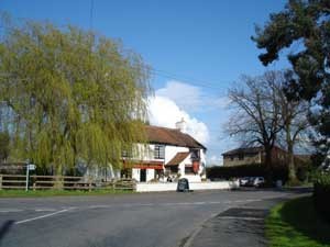
Ebrington Arms
Route 2 - Kirkby on Bain & Roughton
Start from Jubilee Park - Grid Reference: TF 189635
OS Explorer 273
Places of interest: Roughton Moor Wood Nature Reserve, Ostler's Plantation, Kirkby Moor Nature Reserve
Distance:
Traffic: Light, but care needed on short B1191 section
Terrain: Slight inclines
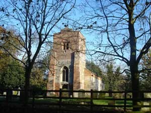
St Margaret's Church, Roughton
From Jubilee Park turn right onto Stixwould road and head for the village centre. Turn left at the mini-roundabout and cycle east along Station Road and The Broadway as far as St Peter's Church. Turn right here on to Iddesleigh Road and bear left almost immediately onto Sylvan Avenue, then turn left onto Tor 'O' Moor Road. Turn right onto Kirkby Lane and continue past the cemetery (2.5 km), Roughton Moor Wood Nature Reserve, the entrance to Ostler's Plantation (3.2km) and onto the Ebrington Arms Public House (6 km) in the village of Kirkby on Bain.
![]()
![]()
![]() Ebrington Arms, Kirkby on Bain: www.ebringtonarms.com
Ebrington Arms, Kirkby on Bain: www.ebringtonarms.com
Turn left at the junction in front of the Ebrington Arms and head north for the village of Roughton . Go past St Margaret's Church (8 km) and turn left at the junction (7.6). Follow the road to the T-junction and turn left onto the B1191 Horncastle to Woodhall Spa road. Cycle towards Woodhall Spa and then turn left onto Sandy Lane (10.5 km).
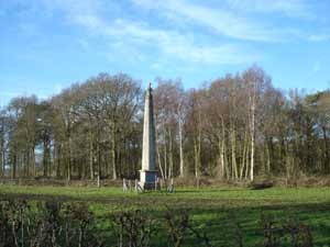
Wellington Monument
Sandy Lane bends to the left and then crosses the track bed of the old Woodhall Spa to Horncastle railway line (10.7 km). (The track bed to the right is now part of the Spa Trail and if you are riding an 'off road' bike you could ride into Horncastle from here). Sandy Lane now heads in a north westerly direction past the Woodhall Spa 'Hotchkin' golf course and several plantations. Turn left at the junction (12.5 km) and you will see the Wellington monument on you right.
Continue along Monument road, past the 'Bracken' golf course, to the cross roads (14.4 km). Turn left onto Stixwould Road and then right into Jubilee Park after 200 yards (14.7 km).
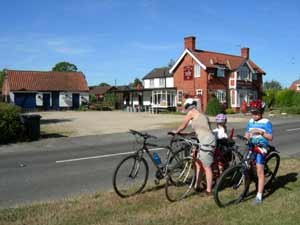
The Elder Tree, Horsington
Route 3 - Horsington & Thimbleby
OS Explorer 273
Start from Jubilee Park - Grid Reference: TF 189635
Places of interest: Horncastle
Distance:
Traffic: Light, but can be fast moving
Terrain: Gentle gradients
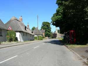
Thimbleby Village
1. From Jubilee Park turn left onto Stixwould Road. and proceed to the village of Stixwould. Turn right for Horsington at the point the road you are on bears to the left (3 km). Pass Stixwould and Horsington woods (on your left) and turn right at the T-junction (6 km) onto the B1190.
![]()
![]() The Elder Tree, Horsington (currently closed)
The Elder Tree, Horsington (currently closed)![]()
2. Continue on the B1190 through Horsington and on to the village of Thimbleby. The road steadily climbs for most of this section with a fairly steep climb over the last half mile into the village and up the main street to the church (11.8 km). The Durham Ox Public House is approximately one third of a mile (12.4 km) beyond the church.
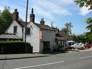
The Durham Ox, Thimbleby
3. At the junction just beyond the Durham Ox turn right for Langton (Option A & B)
Option A. If you would like to visit the historic market town of Horncastle continue along the B1190 and descend the hill to the crossroads with the A158. Go straight across at the junction and turn right at the next T-junction. To return to the route - turn right out of Horncastle market square pass Woolworths on your left. Go straight on at the traffic lights and climb Langton Hill. At the top of the hill turn right and proceed to the ruined mill. Go to 5.
Option B. If you would like to visit Horncastle Garden Centre and its tea rooms continue along the B1190 and descend the hill to the crossroads with the A158. Turn right onto the A153 and continue up the hill and turn left into the nurseries after 400 yards. To return to the route, turn left out of the nurseries and continue up the hill to the next left turn. Turn left on to Green Lane. Turn left at the junction and then turn right just past the Durham Ox pub.
4. Return to Woodhall Spa. Turn right at the junction and then right again just after the ruined mill (13.3 km).
5. Continue on this road through Langton village (14 km), Old Woodhall (16.5 km) past Wellington Monument (19.8 km) to the crossroads (21.5 km). Turn left onto Stixwould Road and then right into Jubilee Park after 200 yards (21.8 km).
Updated 1 Jan 24
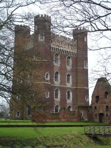
Tattershall Castle
Route 4 - Kirkstead & Tattershall
OS Explorer 261 & 273
Start from Jubilee Park - Grid Reference: TF 189635
Places of interest: River Witham, Tattershall Lakes Country Park, Tattershall Castle, Battle of Britain Memorial Flight, RAF Coningsby airfield viewing area, Thorpe Camp Visitor Centre, Kirkby Gravel Pits Nature Reserve
Traffic: Great care needed crossing A153 section to reach cycle path
Terrain: Mostly flat fenland
1. From Jubilee Park turn left onto Stixwould Road and then left again onto Green Lane. Follow the road round to the left onto Mill Lane and then turn right onto Witham Road (careful this can be a busy road). Cross the River Witham on Kirkstead Bridge (3.1 km) and take the left turn at the bottom of the gradient into the hamlet of Martindales. The road now bends to the right and runs along the Witham embankment all the way to Tattershall Bridge (10 km).
2. Cross the A153 and turn left to cross the River Witham and head for the village of Tattershall. the route passes Tattershall Leisure Park and Tattershall Castle (12.2 km) before entering the village (12.5 km). There are numerous options for refreshments in Tattershall. Continue along the A153 to Coningsby village and the turning left for Woodhall Spa (13.2 km). (Option A or B).
Option A. If you would like to visit the Battle of Britain Memorial Flight or the RAF Coningsby airfield viewing area continue along the A153 past the church and take the right turn in the village centre. Continue along this road, straight on at the mini-roundabout. The Memorial Flight is on your left ( ). After your visit return to the Woodhall Spa junction and turn right.
Option B. Turn left for Woodhall Spa and proceed over the track bed of the disused Lincoln to Skegness railway line to the sharp left hand bend (14.4 km) (Option C or D).
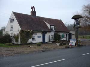
Blue Bell Inn
Option C. If you would like to visit Thorpe Camp Visitor Centre or take refreshment at the Blue Bell Inn continue on the this road into the village of Tattershall Thorpe. The Blue Bell Inn, which dates back to approximately 1250 AD. During the 2nd World War this pub was used by RAF bomber squadrons including 617 ('Dambusters) and 627 (Pathfinders). After your visit return to the road junction and turn left onto Paul's Lane (Option D).
Option D. Turn right onto Paul's Lane and then left ( ) onto the Kirkby on Bain road.
![]()
![]() The Blue Bell, Tattershall Thorpe
The Blue Bell, Tattershall Thorpe![]()

Ebrington Arms
5. The road passes several sand and gravel pits, one of which has become Kirkby Gravel Pits Nature Reserve. Follow the road through Kirkby on Bain village to the road junction by the Ebrington Arms Public House ( ).
![]()
![]() Ebrington Arms, Kirkby on Bain
Ebrington Arms, Kirkby on Bain
6. Turn left here onto Moor Lane and head for Woodhall Spa. The road passes Kirkby Moor Nature Reserve, Ostler's Plantation, Roughton Moor Wood Nature Reserve. Enter Woodhall Spa and turn left at the T-junction onto The Broadway. Continue straight along 'The Broadway' and Station Road and turn right at the mini-roundabout.
There are numerous places to take refreshment along the main street - please visit the Wining & Dining page
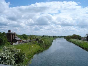
River Witham
Route 5 - Timberland & Martin
OS Explorer 261 & 273
Start from Jubilee Park - Grid Reference: TF 189635
Places of interest: River Witham, Metheringham Airfield Visitor Centre
Traffic: Generally very quiet although care needed on short sections of B1191.
Terrain: Mostly flat fenland, slight climb to Metheringham airfield.
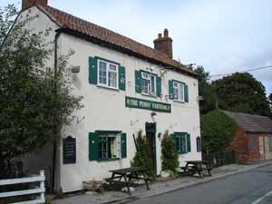
Penny Farthing, Timberland
1. From Jubilee Park turn left onto Stixwould Road and then left again onto Green Lane. Follow the road round to the left onto Mill Lane and then turn right onto Witham Road (careful this can be a busy road). Cross the River Witham on Kirkstead Bridge and take the left turn at the bottom of the gradient into the hamlet of Martindales. The road now bends to the right and runs along the top of the river bank. Continue along ths road for ... miles and then turn left onto Timberland Drove. The road crosses the fen to the village of Timberland. Before the River Witham was canalised it was much wider and meandered between reed beds. It was also tidal for several more miles to the north.
2. Just after the old schoolhouse take the right turn onto Timberland Road and head for the village of Martin.
The Kings Arms, Martindales.
![]()
![]() The Penny Farthing, Timberland.
The Penny Farthing, Timberland. ![]()
3. At the T-junction in Martin turn left onto Moor Lane (B1191) and head for Metheringham and Lincoln. (Option A).
4. Turn right for Blankney Barff. (Option B).
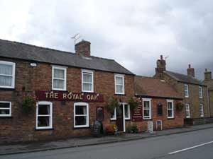
The Royal Oak, Martin
5. You are now cycling along what was once the perimeter track for RAF Metheringham airfield. The main runway ran parallel with the perimeter track at this point. The airfield memorial can be seen on your right hand side.
![]()
![]()
![]() The Royal Oak Public House or the tea room at Holmdale House Garden & Nursery, Martin. Refreshments can also be obtained from the Post Office.
The Royal Oak Public House or the tea room at Holmdale House Garden & Nursery, Martin. Refreshments can also be obtained from the Post Office.
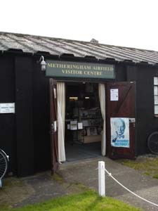
Metheringham Airfield Visitor Centre
6. At the junction, with the sign marking Metheringham Airfield, turn right. The road passes a couple of houses and then drops down on to edge of the Fen again and crosses Carr Dyke (a drainage canal constructed by the Romans). Follow the road round to the right, so that you have the Carr Dyke on your right.. Follow the road round to the left to cross the fen on Blankney Drove. The Drove continues straight for 2 miles followed by a sharp left and sharp right. Turn right at the junction approximately half a mile beyond the sharp right turn. Follow the road all the way to the B1191 and turn left for Woodhall Spa. You can ride on a narrow path as far as the garage, at which point it continues on the other side of the road and crosses Kirkstead Bridge.
![]() Metheringham Airfield Visitor Centre
Metheringham Airfield Visitor Centre
Option A: Turn right for Martin village centre and refreshments.
Option B. Continue straight on to the T-junction with the B1189. Cross the B1189 and proceed down the track to the Metheringham Airfield Visitor Centre. After your visit retrace your route across the B1189 and turn left on to the Blankney Barff road.
Download the Lincolnshire Cycle Routes (Woodhall Spa) pamphlet published by Lincolnshire County Council.
Updated 1 Jan 24